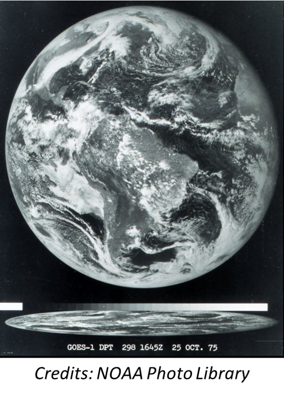
On 16 October 1975, the launch of GOES-1, NOAA's first Geostationary Operational Environmental Satellite (GOES), took place. Just a few days later, on 25 October 1975, it produced its first near real-time full-disk image of the Earth from a fixed position thousands of kilometers away (figure underneath). The GOES are operated by NOAA, and provide critical meteorological data for weather forecasting, severe storm tracking, and research. They are also paramount in monitoring volcanic activity and associated ash plumes.
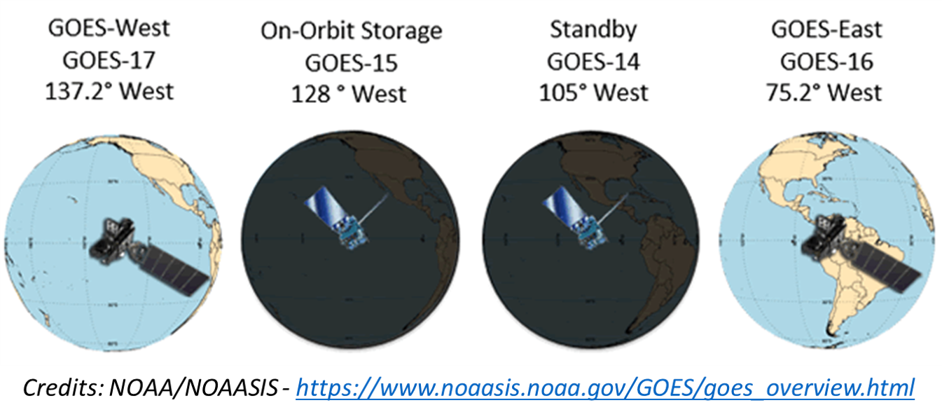
GOES satellites are designated by letters (A, B, C,...). Once a GOES satellite is launched successfully, it gets a number assigned (1, 2, 3,...). For example, GOES-G did not reach its intended orbit afer a premature engine shutdown prohibting the satellite to reach its intended orbit. That's why despite 18 GOES have been launched, the latest GOES carries only the number 17. GOES are operating in a geostationary orbit 35,790 kilometres above the Earth's surface, allowing them to look at the planet from a fixed position. To ground observers it appears motionless, in a fixed position in the sky. That way, earth-based satellite antennas do not have to rotate to track them but can be pointed permanently at the position in the sky where the satellites are located. There are currently 2 GOES operational (GOES -16 and -17), one is in an on-orbit storage mode (GOES-15), and GOES-14 is simply on stand-by.
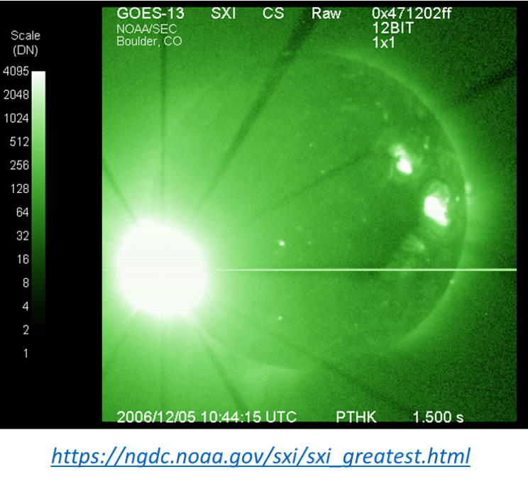
Of course, the space weather community knows GOES from all the data they contribute in the solar-terrestrial domain. Monitoring and forecasting space weather activity would be a whole different story without the indispensable data provided by GOES, such as the solar x-ray flux, proton fluxes for particles of different energies, high-energy electron fluxes, and magnetometer readings amongst other. The latest generation has a Solar Ultraviolet Imager (SUVI - see e.g. this STCE Newsitem for an example), superseding the Soft X-ray Imager (SXI) present on the previous generations. Space weather activity can also be dangerous to GOES. On 5 December 2006, the SXI on board the GOES-13 was crippled by a strong X9 flare produced by NOAA 0930 (underneath - NGDC/NOAA). These outages are rare though, and data delivery is assured by back-up satellites and a consistent GOES launch program. Thank you GOES, and ad multos annos!